
What Is a Construction Survey?
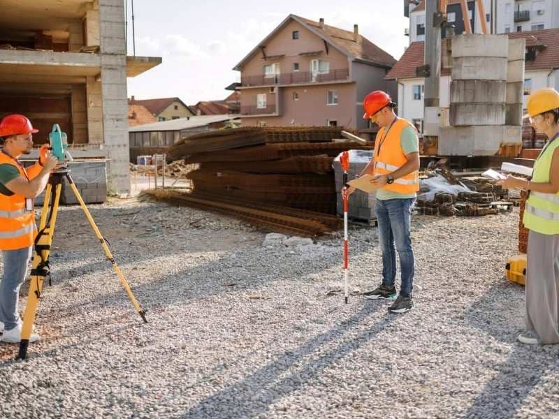
A construction survey places physical markers on a construction site to guide the building process. A licensed surveyor visits the site and sets stakes, hubs, and reference points that show contractors exactly where to build, how high to build, and how to shape the land. Without these markers, even a well-designed building can end up in the wrong spot.
Also called a construction staking survey or site layout survey, this is one of the most important steps in any building project. Yet many property owners do not know it exists until something goes wrong.
What Does a Construction Survey Do?
A construction survey takes an approved design plan and turns it into real, physical points on the ground. Think of it as a connect-the-dots guide for your contractor. The surveyor marks three main things:
- Where to build. Horizontal stakes show the correct position of building corners, roads, parking areas, and utility lines.
- How high or low to build. Vertical grade stakes show the correct elevation for foundations, floors, and drainage.
- How to shape the land. Grade markings guide earthwork crews so water drains away from the structure correctly.
Once these markers are in place, contractors can begin grading, excavating, and building with confidence that everything lines up with the approved plans.
When Do You Need a Construction Survey?
You need a construction survey before any ground is disturbed on a new building, road, utility line, or site improvement. It is required for residential and commercial projects to confirm that work is placed correctly according to engineering plans and within legal property boundaries.
Residential Projects
- New home construction
- Home additions and garages
- Swimming pools and retaining walls
- Driveways and septic systems
Commercial and Civil Projects
- Office buildings, warehouses, and retail centers
- Parking lots and access roads
- Stormwater systems and drainage work
- Road construction and utility installation
If your project requires a building permit, there is a good chance your local government will also require a construction survey before issuing a certificate of occupancy.
Why Is a Construction Survey Important?
A construction survey prevents costly building errors. Without one, structures can be built in the wrong location, violate setback rules, cross property lines, or drain improperly. These mistakes can lead to partial demolition, legal disputes, and failed inspections that delay or stop a project completely.
Skipping a construction survey might seem like a way to save money upfront. In reality, it opens the door to problems that cost far more to fix later. Here are the most common risks:
- Setback violations. Most zoning codes require buildings to sit a certain distance from property lines. If a structure is placed even a few feet too close, the owner may be forced to tear down or modify it.
- Encroachments. Building on a neighbor’s property, even accidentally, creates serious legal problems that can take years to resolve.
- Drainage failures. Improper grading sends water toward foundations instead of away from them, causing flooding and long-term structural damage.
- Permit issues. Many local governments require survey documentation before approving a final inspection. Without it, the project cannot be legally occupied.
According to a study by FMI Corporation, rework caused by layout errors accounts for about 5% of total construction costs on average. On a $300,000 home, that is $15,000 in avoidable mistakes.
What Is Included in a Construction Survey?
A construction survey is not a single visit. On most projects, the surveyor returns to the site several times as different phases of construction begin.
Initial Control Points
The surveyor first establishes horizontal and vertical control points. These are reference benchmarks placed at known coordinates and elevations. All other stakes on the site are measured from these points.
Construction Staking
Once control is set, the surveyor stakes out the specific elements of the project. This includes:
- Building corners and foundation lines
- Curb and gutter alignment
- Utility trench centerlines
- Retaining wall locations
Grade Stakes
Grade stakes tell equipment operators exactly how much soil to cut or fill in each area. Each stake is marked with a number showing how many feet to cut down or build up to reach the correct elevation.
Field Notes and Digital Files
After staking, surveyors provide field notes and digital files, usually in CAD or GIS format. These documents are part of the permanent project record and may be required by lenders or permitting agencies.
How Much Does a Construction Survey Cost?
A construction survey for a residential project typically costs between $500 and $2,500. Commercial projects range from $2,000 to $10,000 or more depending on size, terrain, and complexity. Large infrastructure projects can cost significantly more.
Several factors affect the final price:
- Project size. A larger footprint means more stakes and more time in the field.
- Terrain. Wooded, steep, or swampy sites take longer to work through than flat, open ones.
- Number of site visits. Most projects require the surveyor to return at multiple phases.
- Local rates. Surveying costs vary from one region to another.
The cost of a construction survey is small compared to what it protects. Catching an error before concrete is poured is always cheaper than fixing it afterward.
Who Performs a Construction Survey?
Only a licensed Professional Land Surveyor (PLS) is legally authorized to perform a construction survey. Most states require a four-year degree, years of supervised field experience, and passing the national exams administered by the National Council of Examiners for Engineering and Surveying (NCEES).
Contractors can perform basic layout using plans, but they cannot certify the legal position of a structure relative to property lines. Using an unlicensed layout carries significant legal and financial risk.
According to the U.S. Bureau of Labor Statistics, approximately 44,000 licensed surveyors are employed in the United States.
Frequently Asked Questions
Is a construction survey the same as a boundary survey?
No. A boundary survey determines legal property lines and places permanent corner monuments. A construction survey uses those lines as a reference, then lays out where the improvements will be built. Both are often needed on the same project, with the boundary survey completed first.
How long does a construction survey take?
For a standard single-family home, field work typically takes one to two days. Larger commercial projects may require several days to weeks, with the surveyor returning at phases such as clearing, foundation, utilities, and paving.
Do I need a construction survey for a small addition?
It depends on your local building codes. Many municipalities require setback verification before issuing a permit. Check with your local building department before starting any work.